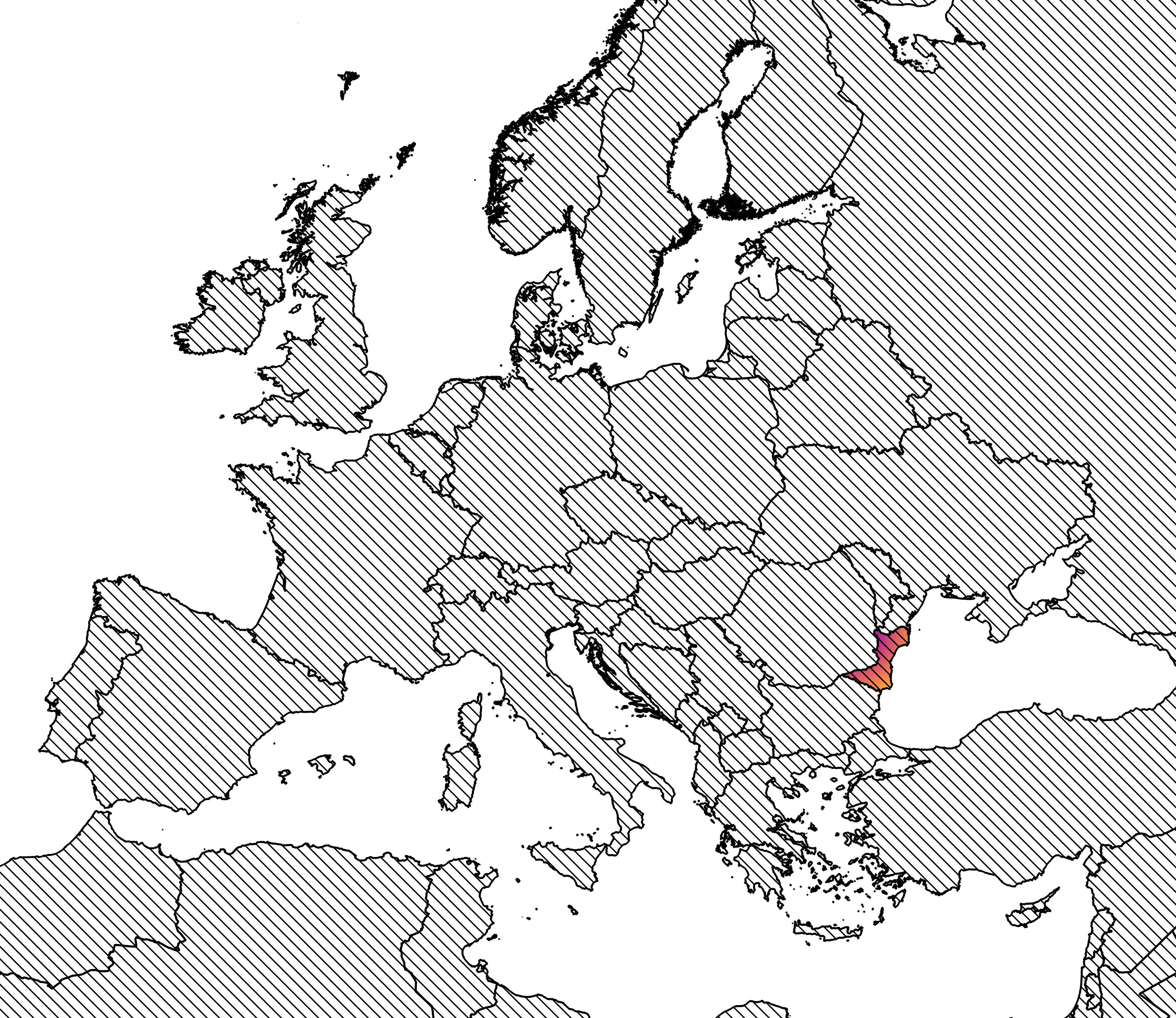
Danetia (officially Danetiska Respublica “Danetian Republic”) is located in the western Black Sea region, occupying the historic territory traditionally known as Dobrudja. The country extends from the lower stretch of the Danube river to the Black Sea, encompassing both fertile riverine lowlands and the elevated Dobrudjan Plateau. It is composed of four provinces:
Danetia lies at a natural crossroads between southeastern Europe and the Pontic-Caspian steppe. It borders Romania to the west, Bulgaria to the south, and Ukraine to the north. At the northwestern corner, it shares a quadripoint with Romania, Ukraine, and Moldova.
Danetia occupies a transitional zone between river delta, coastal plain, and open steppe. The northern reaches approach the Danube Delta, while the eastern frontier opens directly to the Black Sea. Inland, the Dobrudjan plateau forms a gently rolling landscape characterized by grasslands, shallow valleys, and limestone outcrops.
The climate is temperate-continental, marked by hot summers, cold winters, and relatively low precipitation away from the coast. These conditions historically favored mixed agriculture and pastoralism, while the maritime edge supported fishing and trade. The combination of navigable rivers, open plains, and coastal access has made the region unusually permeable to the movement of goods, people, and armies.
Danetia’s position grants it access to two major circulation systems: the Danube Basin, and Pontic maritime routes, connecting the Balkans, Anatolia, the Caucasus, and Crimea. This position makes the region strategically valuable. Control of Danetia implies influence over Danube and Black Sea maritime traffic. Historically, this has placed Danetia at the intersection of inland empires and maritime powers, often making it a buffer zone between competing spheres of influence.
The country’s coastline provides natural harbors, while its interior plains allow relatively unobstructed movement. Unlike the mountainous Balkan regions to the south, Danetia lacks major natural barriers, a feature that has repeatedly shaped its political history.
From antiquity onward, Dobrudja functioned as a frontier province and transit region, successively influenced by Greek colonies, Roman and later Byzantine administration, and various steppe confederations. Its geography attracted migratory peoples from the north and east while remaining economically tied to Black Sea urban centers.
During the medieval period, Danetia emerged as an autonomous state after the settlement of the Danetian people following the defeat of the Pechenegs. Danetia remained within the sphere of influence of the Byzantine empire, and their Ottoman successors.
In the modern era, Danetia’s survival as an independent state can be understood largely through its geography: small enough to require external guarantees for its defense, and strategically important enough to merit them. Its location made it a natural candidate for international oversight and neutrality agreements, particularly during periods of great-power rivalry. As a riverain state, Danetia has belonged to the various Danube River Commissions throughout its history.
Geography has also shaped Danetia’s cultural character. Positioned between Slavic, Balkan, Turkic, and Pontic worlds, the country developed a layered identity influenced by multiple linguistic, religious, and artistic traditions. This blending is reflected in Danetian architecture, music, vocabulary, and institutions.
In short, Danetia occupies a strategically and culturally significant stretch of the Black Sea coast, anchored by the lower Danube, and shaped by centuries of movement across its plains. Its geography explains both its vulnerability and its resilience. Understanding Danetia begins with its geography, a meeting point of land, sea, river, and steppe.